Tropic
Mariners' Museum, Uncurated Search Results
Type: Pungy
Year: 1866
Builder:
Location:
These records are found in the online catalog of The Mariners’ Museum and Park in Newport News, Virginia. Uncurated search results are presented to give researchers and interested readers an idea of whether the museum’s archives contain information about this vessel and whether it may be worthwhile to visit the museum’s catalog search page for further investigation. Uncurated results may be inaccurate or incomplete.
Search mode: Exact Name. Search phrase(s): "Tropic". Results returned: 26. Results displayed in this table: 26.
Use these buttons to send uncurated search results to your own app or text document for further research. First, check the box for any row, or click "Select All" then uncheck any rows. Then click "Show Selections". You can then copy your selections from the text box and past them into your app.
| Fetch? | Row ID | Media | Date | Vessel | Place | Related Places | Inscription/Marks | Subject | Notes | Archive Number |
|---|---|---|---|---|---|---|---|---|---|---|
| 1 | No image URL. | Old Tropic. | LB60880 | |||||||
| 2 | No image URL. | Tropic of Venice. | LB97584 | |||||||
| 3 | No image URL. | Oceania–Description and travel | Through tropic seas __ __by Frank Burnett, with an introduction by Bram Thompson | LB7862 | ||||||
| 4 | 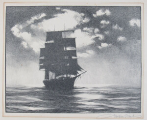 | TROPIC NIGHT | CL12973 | |||||||
| 5 | No image URL. | Honolulu (Hawaii)–History | Tropic landfall : __the port of Honolulu | LB8033 | ||||||
| 6 | No image URL. | Sea birds–Behavior; Sea birds–Ecology | With illustrations. From the National Geographic Magazine, 1938. pp. 226-250. | LB35404 | ||||||
| 7 | No image URL. | Haiti–Description and travel. | Marine animals–Haiti; Birds–Haiti.; Deep diving.; Scientific expeditions. | Frontispiece and one of the plates accompanied by guard sheets with descriptive letterpress. Illustrated lining-papers. A few high-lights of the tenth expedition of the Department of Tropical Research of the New York Zoological Society, making a study of the coral reefs and the fishes in the Bay of Port-au-Prince, Haiti Cf. Pref. | LB27235 | |||||
| 8 | 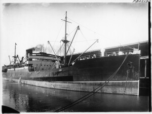 | WRITTEN ON VERSO: FORMERLY YOMAH, TROPIC, STAR, ANJA AT DUMABRTON BY W. DENNY & BROTHERS. OWND BY AUSTRALIA STEAM SHIPPING COMPANY LIMITED, 5,047T, X 4005. X 52.2 X 28.4 | ANJA (STEAMSHIP: ?) | P0001.003/01-#PB25130 | ||||||
| 9 | 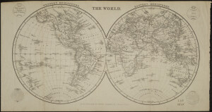 | 1825 | "Drawn & Engraved For White's Geography, By J. Gellatly, Edin.r" | World maps. | the world in two hemispheres; four insets: (1) circles: Arctic, Tropic of Cancer, Equator, Tropic of Capricorn, Antarctic, (2) Zones: N. Frigid, N. Temperate, Torrid, S. Temperate, S. Frigid, (3) Longitude, (4) Latitude | MSM 1/-#0608 | ||||
| 10 | 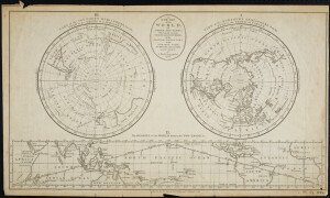 | 1782 | "By J. Bayly, Geographer.1782."; "Published as the Act directs by Harrison & Co. February 1, 1782" | World maps. | Three figures (1) "Part of the Northern Hemisphere, from the Pole to the Tropic of Cancer." (2) "The Regions of the World between the Two Tropics" (3)Part of the Southern Hemisphere, from the Pole to the Tropic of Cancer"; hemispheres 15 cm. diameter. Found in Martyn (William F.) The Geographical Magazine ... vol. 1. 1782. 4 | MSM 1/-#0634 | ||||
| 11 | No image URL. | Tropic Seas (Ketch) | Pacific Ocean | Family at sea | LB15706 | |||||
| 12 | 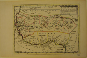 | 1736 | Guinea | "By H. Moll Geographer" | copy 1 of 2 (see MSM 0573). Extends north to above Cape Blanco and the Tropic of Cancer, and south to below the Gulf of Guinea. Locates the Gold, Slave, and Ivory Coasts. The Senegal and Niger are erroneously joined into one river connected by a lake. Filled with interesting notations including "Here are Gold mines." The map number in the upper right hand corner indicates this is from the third edition of Moll's Atlas Minor, published in 1736. | MSM 1/-#0572 | ||||
| 13 | 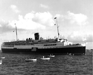 | WRITTEN ON VERSO: STEAMSHIP. BUILT 1932 BY THE NEWPORT NEWS SHIPBUILDING AND DRY DOCK COMPANY, NEWPORT NEWS, VIRGINIA. LAUNCHED FEBRUARY 12, 1932 AT NEWPORT NEWS SHIPBUILDING AND DRY DOCK COMPANY. OWNED BY THE EASTERN STEAMSHIP LINES, INCORPORATED. 6,185 TONS. 387.4 X 61.2 X 27.0. LAID UP AT NORFOLK 1952. SOLD 1955 TO BE BROKEN UP. | Starboard side view of ship docked, many small craft in foreground. From text on photograph 'Tropic daybreak greets the SS ARCADIA at Nassau in the Bahamas on the first of her weekly summer cruises from New York. One of the gayest crowds of young people to visit the islands enjoyed the quaint life of Nassau. " | P0001.003/01-#PB20995 | ||||||
| 14 | 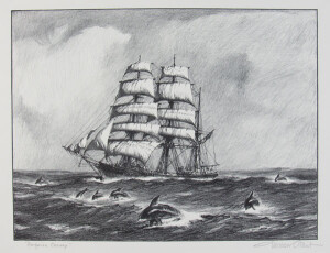 | NOTES: Just a little downeast bark in tropic seas....Gordon Grant | CL8092 | |||||||
| 15 | No image URL. | NOTES: Strong box from an old whaling family named Blossom in New Bedford, Massachusetts. An early strong box no doubt was considered a fine piece of work in its day. Banded and studded by hand. Evidently used aboard ships. Lugs having been on the sides for transportation or lashing to secure in place. NOTES: The New Bedford Whaling Museum whaling crew list database contains the names of several men with the last name Blossom: Edward C. Blossom on ship Abigail (1829, 1831) Benjamin J. Blossom on ship Leonidas (1834) Charles F. Blossom onbark Arab (1843) John Blossom on ship Golconda II (1844) Benjamin H. Blossom on ship Robert Browne (1845) William P. Blossom (12) on bark Frances II (1845) Thomas M. Blossom (18) on ship General Williams (1845) William F. Blossom (14) on bark Bartholomew Gosnold (1847) William Blossom on ship Hunter (1851) Elder Blossom (28) on bark Lark (1853) William Blossom on bark Eben Dodge (1856) William F. Blossom (14) on bark Eben Dodge (1856) Benjamin C. Blossom (18) on ship Hillman (1857), bark Black Eagle (1862), bark Orray Taft (1864), bark Orlando (1870), bark Tropic Bird (1876), brig Isabella (1882, 1884, 1886) David Blossom (23) on ship Eliza F. Mason Benjamin C. Blossom (18) on bark Orlando Benjamin W. Blossom on bark Albion James Blossom (14) on bark John P. West | CL1153 | |||||||
| 16 | 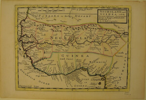 | 1736 | Africa–Maps–Early works to 1800. | "By H. Moll Geographer" | copy 2 of 2 (see MSM 0572). Extends north to above Cape Blanco and the Tropic of Cancer, and south to below the Gulf of Guinea. Locates the Gold, Slave, and Ivory Coasts. The Senegal and Niger are erroneously joined into one river connected by a lake. Filled with interesting notations including "Here are Gold mines." The map number in the upper right hand corner indicates this is from the third edition of Moll's Atlas Minor, published in 1736. | MSM 1/-#0573 | ||||
| 17 | 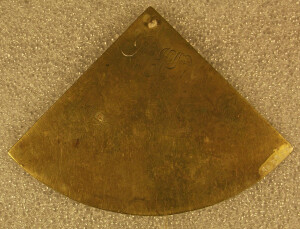 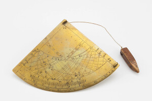 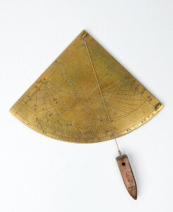 | SHORT DESCRIPTION: [J. Willoz-Egnor, 3/31/2023] Brass gunter-type quadrant with 3-1/2" radius for approximately 52° latitude by an unknown English maker. Signed "S C" at the apex. The instrument has two fixed sights on the face at the right side. There is a large brass plumb bob, probably modern, hanging on string from apex. Time bead missing. The curved edge at the bottom of the quadrant is divided from 0° to 90° in whole degrees. Immediately above the degree arc is a date scale. Above the date scale is a set of hour/azimuth lines. The scale at the left-hand edge is a solar-declination scale, 0°-23-1/2° (the angular distance the Sun moves from the Equinox to the Solstice, 0° is the equator or equinoctial line and 23-1/2° is either of the Tropic of Capricorn or Tropic of Cancer). The set of curving lines to the right of the solar-declination scale is a set of hour/azimuth lines. On the left, the lines marked with Arabic numerals (6 through 12) converging on the equinoctial line are two sets of hour lines (the lines curving to the left are for the winter half of the year and the lines curving right are for the summer half of the year). On the right side are sets of curving lines used to calculate the Sun's azimuth (direction East or West). Sets of lines are marked for 30°, 60° and 90° on the equinoctial line and 100°, 110° and 120° on the right edge. No degrees are noted on the bottom left of the scale. Like the hour scale, the lines curving to the left are for winter and the lines curving right are for summer. There are no stars plotted on the hour/azimuth scales. At the apex is a shadow square, the linear shadow scales are labeled 0-50-0 with numerals 10 through 50 marked. Scale divided into 10 parts on each side. The tip of the shadow square deeply intersects the equinoctial line. The reverse is blank with the exception of a number of later, decorative engravings and the name "John Halford" an unidentified figure and text that appears to read "St. Alb". The name is probably of a previous owner. NOTES: An identical quadrant with the letters "S C" at the apex of the instrument was sold at Bonham's in December 2016 leading one to believe that these are the initials of the maker. NOTES: Excerpts from 'Sundials, an Illustrated History of Portable Dials' by Hester Higton, pages 72-73, states this about Edmund Gunter: Among the 'other instruments' of which he speaks [Gunter] in the title was a quadrant of his own devising, which could be used for various purposes in astronomy and surveying, but whose chief function was time-telling. It became the last important innovation in altitude dials, whose popularity had waned with the introduction of portable horizontal and equinoctial dials. The Gunter quadrant as described by its inventor carried the following instruments: a set of hour lines and a date scale for use in time-telling; a set of lines for calculating the azimuth (direction East or West) of the sun; a shadow square for use in surveying; and, on the reverse, a nocturnal for telling the time at night...The parts which are required for telling the time are the degree scale running along the curve of the quadrant, the date scale immediately above it, the curving lines on the left which are marked with the hours in Roman numerals, and the sights on the right-hand edge of the instrument. There is also a string attached to the hole at the apex of the quadrant, carrying a plumb bob and a bead. [See page 73-74 for a thorough description of how to use the instrument.] | CL26262 | |||||||
| 18 | No image URL. | NOTES: Accession includes souvenirs ofa sailor's service during world war II. The pennants were acquired from various duty stations in Florida and the Pacific (Hawaii, Tonga, Fiji). | CL27585 | |||||||
| 19 | 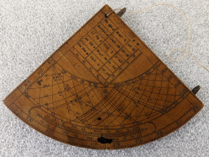 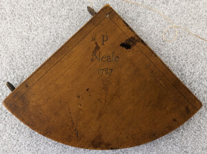 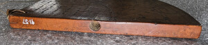 | SHORT DESCRIPTION: [J. Willoz-Egnor 3/31/2023] Boxwood gunter-type quadrant for approximately 53° latitude with two fixed brass sights on its right edge. By an unknown English maker. At the apex of the instrument there is a string with a small lead bead (time bead) about an inch above a cylindrical lead plumb-bob at its bottom. There is a hole on the left edge that would be used to store the plumb bob when the instrument was not in use. As the current plumb-bob does not fit into this hole it is probably a replacement. The curved edge at the bottom of the quadrant is divided from 0° to 90°. Immediately above it is a date scale. Above the date scale is a set of hour/azimuth lines. The scale at the left-hand edge is a solar-declination scale, 0°-23-1/2° (the angular distance the Sun moves from the Equinox to the Solstice, 0° is the equator or equinoctial line and 23-1/2° is either of the Tropic of Capricorn or Tropic of Cancer). To the right of the solar-declination scale is a set of curved hour/azimuth lines. On the left, the sets of curved lines converging on the equinoctial line marked with Roman numerals are two sets of hour lines (the lines curving to the left are for the winter half of the year, and the lines curving right are for the summer half of the year). On the right, the sets of curved lines converging on the equinoctial line marked from 20° to 90° at the top of the scale, 10° to 50° at the bottom, and 90° to 130° on the right edge are used to calculate the Sun's azimuth (direction East or West). Like the hour scale, the lines curving to the left are for winter and the lines curving right are for summer. At the apex is a shadow square with a table of five stars (table of right ascensions) (Pegasus wing, Arcturus, Lion's heart, Bull's eye and Vulture's heart), months and days (March 8, October 14, August 7, May 16 and January 1), and hours and minutes (23:54, 18:58, 9:48, 4:15 and 19:33) (the star positions). The same five stars have been plotted on the scale of hours and azimuths. The linear shadow scales are labeled 0-10-0, with only even numbers marked (2 through 10), with divisions of five between each number (divided into 25 parts on each side). The reverse of the instrument is blank except for the signature 'P. NEALE, 1727' with a spiraling decorative flourish underneath at the apex. This is probably the name of an owner. NOTES: Excerpts from 'Sundials, an Illustrated History of Portable Dials' by Hester Higton, pages 72-73, states this about Edmund Gunter: Among the 'other instruments' of which he speaks [Gunter] in the title was a quadrant of his own devising, which could be used for various purposes in astronomy and surveying, but whose chief function was time-telling. It became the last important innovation in altitude dials, whose popularity had waned with the introduction of portable horizontal and equinoctial dials. The Gunter quadrant as described by its inventor carried the following instruments: a set of hour lines and a date scale for use in time-telling; a set of lines for calculating the azimuth (direction East or West) of the sun; a shadow square for use in surveying; and, on the reverse, a nocturnal for telling the time at night...The parts which are required for telling the time are the degree scale running along the curve of the quadrant, the date scale immediately above it, the curving lines on the left which are marked with the hours in Roman numerals, and the sights on the right-hand edge of the instrument. There is also a string attached to the hole at the apex of the quadrant, carrying a plumb bob and a bead. [See page 73-74 for a thorough description of how to use the instrument.] TIME-SPACE: 1660-1730. | CL20730 | |||||||
| 20 | No image URL. | NOTES: Sketchbook No. 32 of pencil drawings created by Antonio Jacobsen from 1878 to 1918 for his artworks. VESSELS LISTED IN SKETCHBOOK NO. 32, 1889 HABANA (Screw Steamship) (Service Dates 1872-1900) DE RUYTER (Screw Steamship) (Service Dates 1873-1894) DAVENTRY (Screw Steamship) (Vessel Built 1889) GLENORCHY (Half Brig) (Vessel Built 1883) ALICE (Half Brig) TEUTONIC (Screw Steamship) (Service Dates 1889-1921) EVVIVA (Half Brig) (Vessel Built 1876) WILLIAM H. MACY (Ship) (Service Dates 1883-1915) CROTON (Screw Tug) (Vessel Built 1881) NELLIE MAY (Screw Steamship) (Vessel Built 1860) KAISER WILHELM II (Screw Steamship) (Service Dates 1889-1908) M.H. FULLER (Barge) WASHINGTON (Bark) (Vessel Built 1874) UNDAUNTED (Ship) (Service Dates 1869-1912) BEATRICE (Schooner, 2) AUGUSTA VICTORIA (Screw Steamship) (Service Dates 1889-1907) TROPIC (Screw Steamship) (Vessel Built 1888) BRITANNIA (Screw Tug) (Service Dates 1879-1931) ALBERT (Screw Steamship) (Vessel Built 1884) EDITH HOUGH (Screw Steamship) (Vessel Built 1869) ORANGE NASSAU (Screw Steamship) (Service Dates 1883-1906) ATLANTA FAIRFIELD (Half Brig) (Vessel Built 1873) MENDEZ NUNEZ (Screw Steamship) (Vessel Built 1870) LA FLANDRE (Screw Steamship) (Vessel Built 1888) OLIVETTE (Screw Steamship) (Service Dates 1887-1918) PLANT LINE, CANADIAN ATLANTIC AND PLANT STEAMSHIP COMPANY, CARACAS (Screw Steamship) (Service Dates 1881-1888) JOSEPH H. PEENE, SR. (Screw Tug) (Vessel Built 1889) ALLIANCA (Screw Steamship) (Service Dates 1886-1924) | CL28301 | |||||||
| 21 | 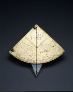 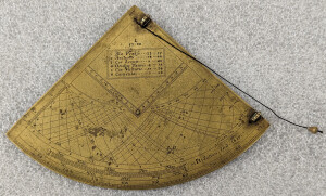 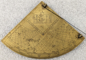 | SHORT DESCRIPTION: [J. Willoz-Egnor, 3/31/2023] Brass gunter-type quadrant dated 1657 by English instrument maker Henry Sutton for latitude 53°20' (possibly Liverpool). The instrument has two fixed sights on the face at the right side. Brass plumb bob, possibly modern, hanging on black string from apex. Time bead missing. The curved edge at the bottom of the quadrant is divided from 0° to 90°. Immediately above it is a date scale. Above the date scale is a set of hour/azimuth lines. The scale at the left-hand edge is a solar-declination scale, 0°-23-1/2° (the angular distance the Sun moves from the Equinox to the Solstice, 0° is the equator or equinoctial line and 23-1/2° is either of the Tropic of Capricorn or Tropic of Cancer). The set of curving lines to the right of the solar-declination scale is a set of hour/azimuth lines. On the left, the lines marked with Arabic numerals (6 through 12) converging on the equinoctial line are two sets of hour lines (the lines curving to the left are for the winter half of the year, and the lines curving right are for the summer half of the year). On the right side are sets of curving lines used to calculate the Sun's azimuth (direction East or West), the lines are marked from 10° to 90° at the top of the scale, 10° to 40° at the bottom, and 90° to 130° and 80° to 50° on the right edge. Like the hour scale, the lines curving to the left are for winter and the lines curving right are for summer. At the apex is a shadow square with a table of six stars and the hour and minute of the star's meridian transit (table of right ascensions). The stars are: Pegasus wing 23-55, Arcturus 14-00, Lion's heart 9-48, Bull's eye 4-16, Vulture's heart 19-34, and Canicula (Sirius) 7-24. The same six stars are plotted on the scale of hours and azimuths. The linear shadow scales is labeled 0-10-0, with numerals 1 through 9 marked. Scale divided into 50 parts on each side. On the reverse is scale of hours, numerals 1-12 twice, divided by eighth of hour. At the top is a degree scale 0° to 90° to 0° spanning 6-12-6 on the hour scale and numbered every 10˚. Two additional logarithmic scales from 0-90 units running between numerals 6 to about 9:30 at the left and between 6 to about 2:20 on the right. The scales and the remains of a brass pin at the center indicate that this instrument was once fitted with a brass volvelle (planispheric noctural). There is a fleur de lis at the apex. NOTES: Excerpts from 'Sundials, an Illustrated History of Portable Dials' by Hester Higton, pages 72-73, states this about Edmund Gunter: Among the 'other instruments' of which he speaks [Gunter] in the title was a quadrant of his own devising, which could be used for various purposes in astronomy and surveying, but whose chief function was time-telling. It became the last important innovation in altitude dials, whose popularity had waned with the introduction of portable horizontal and equinoctial dials. The Gunter quadrant as described by its inventor carried the following instruments: a set of hour lines and a date scale for use in time-telling; a set of lines for calculating the azimuth (direction East or West) of the sun; a shadow square for use in surveying; and, on the reverse, a nocturnal for telling the time at night...The parts which are required for telling the time are the degree scale running along the curve of the quadrant, the date scale immediately above it, the curving lines on the left which are marked with the hours in Roman numerals, and the sights on the right-hand edge of the instrument. There is also a string attached to the hole at the apex of the quadrant, carrying a plumb bob and a bead. [See page 73-74 for a thorough description of how to use the instrument.] NOTES: Henry Sutton died during the plague of 1665. In 1758, long after Sutton's death, Edmund Stone said of his work: Mr Sutton's Quadrants, made above one hundred Years ago, are the finest divided Instruments in the World; and the Regularity and Exactness of the vast Number of Circles drawn upon them is highly delightful to behold." TIME-SPACE: 1650-1660. | CL9235 | |||||||
| 22 | 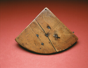 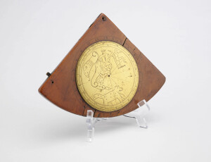 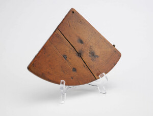 | SHORT DESCRIPTION: Boxwood gunter-type quadrant by an unknown English maker for approximately 52° latitude (several cracks in the instrument, one quite large make it impossible to make an accurate measurement) with a brass polar volvelle (planispheric noctural) on the reverse. There is one fixed brass sight on its right edge (the second is missing). The string and plumb-bob are also missing. There is a hole on the left edge that would be used to store the plumb bob when the instrument was not in use. The curved edge at the bottom of the quadrant is divided from 0° to 90°. Immediately above it is a date scale. Above the date scale is a set of hour lines. The scale at the left-hand edge is a solar-declination scale, 0°-23-1/2° (a declination scale that that marks how far the Sun is above or below the celestial equator, 0° is the equator or equinoctial line and 23-1/2° is either of the Tropic of Capricorn or Tropic of Cancer). The set of curving lines to the right of the solar-declination scale is a set of hour lines. On the left, the lines marked with Arabic numerals ( 1 through 12) and converging on the equinoctial line are two sets of hour lines (the lines curving to the left are for the winter half of the year, and the lines curving right are for the summer half of the year). On the right side are sets of curving lines used to calculate the Sun's azimuth (direction East or West), marked from 10° to 90° at the top of the scale and 90° to 120° along the right edge. Like the hour scale, the lines curving to the left are for winter and the lines curving right are for summer. Interestingly, there are no degrees indicated at the bottom of the hour scale on the right. Five stars are plotted on the scale of hours and azimuths (PW=Pegasus wing; Arc=Arcturus; LH=Lion's heart; BE=Bull's eye; and VH=Vulture's heart). At the apex is a shadow square. The linear shadow scales are labeled 0-10-0, with numerals 1 through 9 marked with each division divided into five give a scale divided into 50 parts on each side. On the reverse is a brass polar volvelle (nocturnal) is used for determining time. The dials shows five circumpolar constellations: Ursa Major, Ursa Minor, Cepheus, Draco and Cassiopeia. The rotating brass plate appears to be connected to a smaller iron plate on the interior of the instrument. Five iron pegs extend from the plate through the face of the gunter scale projection on the obverse. Four smaller holes indicate the presence of another connection point at some point in the past. The only way this plate could have gotten on the side was if the quadrant was already broken in half. It seems that the interior iron plate and two iron staples that are currently holding the cracked instrument together are a repair. The repair has caused several cracking in the wood. See the attached xray, which shows an interior plate of irregular shape that matches to the five rivets on the outside. The xray shows the very large staples holding the crack together and does give the impression that the plate/rivets are part of poor repair job. NOTES: [J. Willoz-Egnor, 4/3/2023] The gunter-scale projection on this instrument has several odd features making one wonder if this instrument was constructed by an amateur. On the left edge (with scale side up) there are scratches marking the placement of the lines of the hour/azimuth scale. In addition, the shadow scale deeply intersects the scale of hours and azimuths. Also, there are no degree markings at the bottom of the hour/azimuth scale on the right. NOTES: Peter Ifland, Taking the Stars, pg. 145: On the back of this English quadrant is a shadow square that has each side divided into units of ten and each of these is further divided into five units. The decimal scale of the English quadrant was considerably easier to use than the dodecyl (units of twelve) scale of the Persian astrolabe; the height/distance ratio was a decimal number that could be easily multiplied with the known height or distance. J.A. Bennett, The Divided Circle, A History of Instruments for Astronomy, Navigation and Surveying, pg. 77-79: the nocturnal was used for finding the time at night, and a skilled practitioner might expect an accuracy within a quarter of an hour. The instrument was introduced in the sixteenth century remained popular until at least the middle of the eighteenth…The larger, wooden nocturnals, usually in boxwood, generally English and dating to between the mid-seventeenth and mid-eighteenth centuries…The wooden ones are more like shipboard instruments, and this is confirmed by the fact that they almost always carry additional scales related to latitude finding and tide prediction…A different type of nocturnal, described by Edmund Gunter as a “Nucturnall for the use of seamen,” is sometimes found on the reverse of an horary quadrant. It has a solid, circular volvelle with an engraved planisphere marked with a few prominent stars and constellations, and a date scale. This moves over a time scale, divided into quarter hours. The planisphere is simply made to correspond with the orientation of the night sky, and the time is given against the appropriate date. After orienting the planisphere, the time scale is read at the appropriate date. NOTES: A nearly identical polar volveele, although of much higher quality, is pictured on page 73 of 'Sundials, an Illustrated History of Portable Dials' by Hester Higton. See pages 73-74 for a description of the gunter quadrant and how to use it. Page 74 discusses the use of the nocturnal. | CL26185 | |||||||
| 23 | 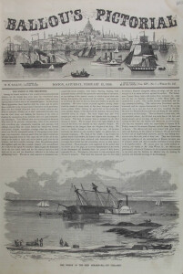 | NOTES: Published in Ballou's Pictorial, February 13, 1858, Volume XIV, No. 7. The image shows the ship Serampore, off Cohasset, Massachusetts, heeled over on her starboard side with the steamer Neptune alongside. VESSEL INFORMATION: VESSEL NAME: SERAMPORE SHIP BUILDER: TALBOT SHIPBUILDER LOCATION: BOSTON, MASSACHUSETTS SHIP OWERN: BRAS d'OR STEAM CO. | CL24144 | |||||||
| 24 | 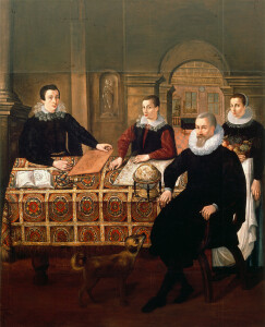 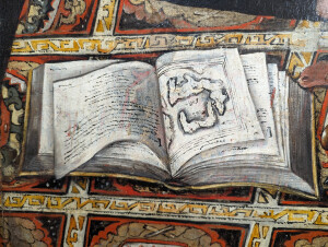 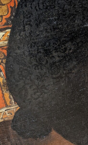 | SHORT DESCRIPTION: Oil painting on canvas, 9’ high by 7’ wide, showing a family portrait by an unknown Dutch/Flemish artist, circa 1625-1635. Current research (March 2024) suggests that the sitters are Willem Janszoon Blaeu (1571-1638), his sons Joan (also Johannes) Willemszoon (1597/1598-1673) and Cornelis (1610-1644) and his wife, Maritge (1575-1637) or a daughter (Blaeu had four: Christina (born 1600), Sijtge (born 1601), Stijntgen (born 1607), and Catherina (born 1611)). The family sits or stands around a table covered with a Spanish fringed carpet (the carpet was identified as Spanish by Gertrude Tomsend, the curator of textiles at the Museum of Fine Arts in Boston on October 27, 1953) with a repeating medallion of a floral-like motif wrapped with a white band with a repeating gold colored geometric design. Objects and implements related to the Blaeu’s trade (cartography/publishing/globe making) cover the tabletop. At the right, Willem Blaeu sits in an x-frame (also called Savonarola) armchair. His body is slightly turned to the left but he is looking towards the viewer. Blaeu is dressed in black from head to toe, and although it’s difficult to see, the material is intricately patterned with a floral design. He appears to be wearing a doublet with split sleeves over a waistcoat patterned with an overall slash design. He wears a large, elaborately folded white ruff. Blaeu’s left hand is wrapped around the handle of the armchair and his right hand is wrapped around the edge of the table. He wears a gold ring with scalloped decoration surrounding a dark square stone on his smallest finger. Blaeu’s hair is close cropped and gray or gray-blond. He has a mustache and a longish, square gray or gray-blond goatee, and his cheeks appear close-shaved. Standing behind Blaeu is a woman wearing a lace edged coif over her brown hair and a stiff round collar edged with delicate lace. The joint in the collar can be seen under the woman’s chin. She is wearing a black jacket, a blue skirt and a long white apron. Her left hand hangs at her side, but she is lifting the edge of her apron with her index finger and thumb. She wears a decorative gold band on her ring finger. The ring has three ribs running around her finger and the ribs appear twisted so that they run diagonally for a short distance on the side of the ring facing the viewer. The woman is holding a basket of fruit (apples, pears, green and grapes and figs on the stem with leaves still attached) in her right arm. The woman’s body is turned slightly left but she is looking towards the viewer. [J. Willoz-Egnor: I believe this woman is a member of the family rather than a servant because of the decorative lace collar, which a servant wouldn’t wear and because her gold ring matches that worn by Cornelis.] Sitting behind the table to the left of Blaeu and at the center is his younger son Cornelis (he appears to be 14 to 17 years old). His body is turned left but he is looking towards the viewer. His right hand rests on the table with fingers bent and his elbow is lifted over the table. He has short brown hair. Cornelis is wearing a black split sleeve doublet over a silky-looking burgundy waistcoat with an overall slash decoration. He wears a stiff collar edged with point coupé lace (it is not a falling collar). Cornelis’s left forearm and hand rests on the map on the table. He wears a gold ring on his little finger that is very similar to the one worn by the woman. To Cornelis’s left sits his older brother Joan who, like his father, is wearing a decorative black outfit consisting of a split sleeve doublet over a decorative black waistcoat. He wears a small stiff collar edged with point coupé lace. Joan’s body is turned towards the right but he is looking at the viewer. He wears a belt with a decorative gold clasp at his waist. Joan’s right forearm and hand rest on the table, in his left hand he supports and raises the corner of a copper printing plate etched with a map. The background seems to indicate that the Blaeu’s live in a large house with tall ceilings. To Joan’s left there is a large pedestal supporting a column. On the wall behind and between Joan and Cornelis a niche holds a statue of Hope with her anchor. To the right of Cornelis and behind Willem is a large double doorway with pedestal’s supporting arches. In the extreme background is a large room with a tiled floor with a checkerboard pattern and a coffered wood ceiling. Sitting on the floor is a long rectangular table with turned legs connected by an H stretcher. The table is covered with a black tablecloth. There are two tall, wood framed windows with decorative iron hardware at the joints of the frame, which creates four panels of leaded lights. Within the upper panels there appear to be inserted circular medallions decorated with a figure. The lower half of the window on the left has an open wood shutter with decorative iron hinges and latch. Outside the same window are flowering plants. Between and over the windows is a small circular window with rectangular leaded lights. To the left of the windows is either an open doorway, a tapestry or a painting (the latter two things were suggested because a shadow to the right seems to indicate the panel is raised from the wall). There is a triangular pediment over the doorway/tapestry/painting. The same flowering plants appear in the lower part of the image (suggesting this is simply a poorly rendered doorway).The plants are growing through a railing with decorative turned posts. Several trees are also present, one of which is sculpted into graduated rings but a point at the top (it almost appears Seussean). In the center foreground is a small brown dog with a curled tail looking up towards Willem. The objects laying on the table are the key to identifying the portrait sitters. First, the globe, identified by staff at the National Maritime Museum at Greenwich as Dutch and dating to circa 1610, is of the sort produced by Willem Blaeu. While the globe is artistically rendered, it bears a remarkable resemblance to a 1602 Blaeu globe in the collection of the Skokloster Castle in Sweden. The globe is mounted in a stand with black turned wooden legs and a natural colored foot and turned base at the bottom. The horizon ring at the top of the stand carries the months (January through August are visible) and days of the year. A brass-looking meridian band with some degree marks visible on the right side wraps the globe. A brass hour dial is at the North Pole. The north pole of the globe is tilted towards Blaeu. Visible on the globe are the meridian and the equator/equinoctial lines (the ecliptic is not visible), the tropic of cancer and the arctic circle are rendered as bright orange lines. The second object on the table is a map lying flat behind the globe and in front of Cornelis. It has been identified as Blaeu’s ‘Americæ nova tabula’ which was first produced in 1614 as a standalone map that began appearing in atlases in 1617. ‘Americæ nova tabula’ is a general map of the Americas that is one of the longest-lived atlas plates. Some parts of the map, although artistically rendered, are readily identifiable. On the right side of the map (as if you were looking at it in the correct position) four border cartouche images are visible: Peruviani, Brasiliani, Brasiliani milites and Insulani de la moche in Chili. The images show couples of South American natives in appropriate dress and settings and with implements or items specific to their culture. At the top right of the map two cartouches of the map are visible: ‘Olinda in Pharnambucco’ and ‘Rio Ianeiro.’ On the map itself, at the top right the European continent is visible and identified by the words “EUROPÆ PA” (the R is only partially visible and may have disappeared during a past cleaning). The letters “ANUS,” part of the word ‘oceanus’ with the ‘oce’ under the globe, is visible to the left of the European coastline. Down the right side of the map the edge of the African continent is visible and identified with the words “AFRICÆ PAR” (the S is under Cornelis’s ring finger). The South American continent is partially visible behind the globe. The letters “AM,” part of “America Sep,” are visible near Willem’s elbow as are “DEL ZUR” on the Pacific Ocean. The Tropic of Capricorn is visible before Cornelis’s elbow and forearm (it disappears under his hand). The third item is the map depicted on the copper plate which appears to be a version of Blaeu’s ‘Novus XVII, Inferioris Germaniæ Provinciarum Typus.’ This map was first issued in 1608 as a separately published map with decorative borders. Later, the borders were removed in order to publish it in Blaeu’s first atlas, the ‘Atlantis Appendix,’ which was published in 1630. The words ‘Zuyder Zee’ are clearly visible on the right side of the map (if the viewer were looking at the map straight on and in the upright position). A decorative cartouch is in the upper right corner. It has letters on it but only a few can be identified (‘N VII BROW…’). To the left of the cartouche is a compass rose. The small book sitting on the left end of the table appears to be an artistically rendered map of Holland and the Zuiderzee. It looks suspiciously similar to Gerard Mercator’s map titled “Hollandiæ comitatus” in the ‘Atlas minor Gerardi Mercatorio.’ Since Blaeu did not go out and take measurements of land masses himself, but designed maps based on existing maps and books, ship logs, travel reports and conversations with sailors this would be a perfectly appropriate source to find sitting on his table. Additional evidence for the attribution to a cartographer comes from the tools sitting between the open book and the engraved copperplate, all of which are tools used in the creation of copper printing plates. The implements include a square, two gravers/burins, a burnishing tool, a set of dividers, a ruler, and a unique copper tool that may be an early form of curve–maybe even something created by or for the Blaeu’s to assist them in their work. Former senior curator of navigation at the Nederlands Scheepvaartmuseum in Amsterdam, Willem Mörzer Bruyns, commented: “the flat, polished copper object could indeed be a unique instrument. It has three curves or three different radii. My thought is that it could have been used as a 'ruler' to engrave or etch curves on the copper plate. The hole would be to secure the plate while 'curving'.” NOTES: The artistic quality of this painting is poor in certain places. First, parts of it have been poorly rendered suggesting that the artist was not the most talented (see the shape of the globe). For another example, the perspective of the table and rug have not been accurately rendered. The right arms of Willem and Cornelis are also awkwardly depicted. The dog has also not been portrayed well nor the Dr. Seuss-like trees in the background. Some of these problems may be due to past conservation/restoration work. See the 1991 conservation treatment report by Christine Daulton for details. NOTES: On October 27, 1953, Gertrude Tomsend, curator of textiles at the Museum of Fine Arts, Boston provided the following discussion about the lace on the collars of the young men and woman: Since the same patterns not only appear in succeeding editions of a book, but were sometimes taken over by other publishers without giving credit, it is not safe to date lace too precisely by matching designs. The patterns of the lace which trim the collars of the young men in the painting resemble closely some in ‘Les Singuliers et Nouveaux Pourtraicts, du Seigneur Federic de Vinciolo Venitien, pour toutes sortes d'ouvrages de Lingerie,’ Paris, 1606. We have a facsimile of this edition dedicated to the Dowager Queen of France, but there were a number of earlier editions (1567, 1566, 1594, etc.) The French description of this lace is "Ouvrages de point couppe,” to quote from our facsimile. Similar lace in the ‘Teatro delle Nobili et Virtuose Donne,’ by Elisabetta Catanea Parasole, Rome, 1616, is called "Lavori di Ponto Reticella". Both names are still used, point coupé and reticella (or reticello), among the names for this type of needlepoint lace. Punto tagliato is, of course, the translation of point coupé. Because none of the linen appears in the lace today, we would call this (punto a) reticello. It is more difficult to be certain about the lace round the young woman’s collar. This, too, is probably needlepoint, but it may be bobbin lace of the same period, and type. The fact that lace of this type originated in Italy during the latter part of the sixteenth century and continued to be fashionable into the seventeenth century, does not preclude its having been made almost anywhere in Europe at that time. Ms. Tomsend also confirmed that looking at the clothing the painting dated to the first part of the 17th century. NOTES: Willem Janszoon Blaeu (also spelled Blaeuw) was born in Alkmaar or Uitgeest in 1571. He started out as a clerk in his uncle’s herring trade, but later began studying mathematics. In 1594 he went to Denmark and served as an assistant to astronomer Tycho Brahe on the island of Hven. During that time Blaeu learned the theory and practice of making astronomical observations and the arts of instrument and globe making. Blaeu returned to Amsterdam in 1596 and opened a business as a globe and instrument maker, a publisher of navigation guides and maps. He married Maritge Cornelisse van Uitgeest in 1596 or earlier and their first son, Joan was born in September of 1596. By 1610 the Blaeu’s had nine children. When his business began to suffer due to decreasing trade Blaeu began looking for other sources of income and decided that the publication of a new atlas might be a lucrative project. He acquired 37 copperplates of maps produced by Jodocus Hondius the Younger for an updated atlas (Jodocus died in 1629 before his atlas could be published) and added 23 maps of his own and published the ‘Atlantis appendix, sive pars altera’ in 1630. A year later Blaeu published a larger supplement to the ‘Atlantis appendix’ with 100 maps called ‘Appendix Theatri A. Ortelii et Atlantis G. Mercatoris.’ Joan, who held a doctorate from the University of Leiden, joined his father in the business in 1630 and the 1631 ‘Appendix Theatri’ was the first publication to carry both Willem and Joan’s names. In 1634, a German edition of the atlas (titled ‘Novus atlas, das ist Abbildung und Beschreibung von allen Ländern des Erdreichs’) was published and the following year French (titled ‘Le théâtre du monde’), Dutch (titled ‘Toonneel des Aerdrycks’) and Latin (titled ‘Theatrum orbis terrarum’) editions were published. The two part atlases containing some 210 maps published in four languages gave the Blaeu’s a distinct advantage over rival publishers Henricus Hondius and Johannes Janssonius. In 1635 Willem became the official mapmaker of the Dutch East India Company (VOC; Verenigde Oostindische Compagnie). In this position he made and supplied charts and compiled sailing directions for the company’s navigators. Third and fourth parts of his ‘Appendix Theatri’ were in production when Willem died in 1638. Joan, assisted by Cornelis, took over the business. After Cornelis’s death in 1644 Joan continued the business alone and established his own reputation as a great mapmaker creating the largest printing house in Europe and effectively the largest printing business in the world. Besides continuing his father’s role as mapmaker to the VOC Joan completed Willem’s final atlas project in 1655 with the publication of the sixth and final volume of the ‘Atlas novus’. He began work on an even larger atlas titled ‘Atlas maior’ published in 1662 and felt to be the “greatest and finest atlas ever published.” Joan’s creation of his town books between 1649 and 1672 firmly established the eternal fame of the Blaeu name. On February 23, 1672 Joan Blaeu’s printing house in Gravenstraat burned down destroying the business. One year later Joan died ending the business forever. Five public auctions were held in 1674 and 1677 dispersing the remaining books, atlases, printing plates and globes to map dealers and publishers in Amsterdam. The printing department at Bloemgracht continued, managed by Joan’s three sons, until 1695 when the business was closed and the inventory was sold at auction. NOTES: [John Sands, 2/14/1979] Richard Wonder felt this was probably a significant painting, but that it had been extensively overpainted - he pointed out that he felt even the faces might have been overpainted. He felt the varnish was a heavy bituminous type often applied in the 19th century, and suggested that the cracking probably goes through the paint layer. | CL8728 | |||||||
| 25 | No image URL. | Astrolabes; Astronomical instruments | The astrolabe __ __by James E. Morrison | LB101936 | ||||||
| 26 | 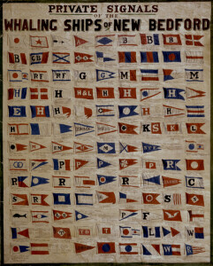 | SHORT DESCRIPTION: Oil painting on canvas by C. Newton titled 'Private Signals of the Whaling Ships of New Bedford.' There are many company/merchant flags shown with the names of their vessels and dates of operation underneath each flag. Looking at the dates of the vessels the painting appears to have been created sometime in the 1840s and received modifications as new ship's were added to each. There do not appear to be any entries made after 1869. NOTES: For information, see New Bedford Whaling Museum finding aids. Newspaper and other references found in object file. Gideon Allen and his brother, William, were whaling agents and investors from 1830 to 1887. Philip Anthony worked as a ship chandler and sold hardware at 91 Union in the 1841 New Bedford City Directory. He owned ship Menkar from at least 1845 to 1854. James Arnold was a merchant at Rotch's square. He owned the ship Cambria, which transported Frederick Douglass in 1847. George F. Barker and Abraham Barker were merchants at 117 Union in the early 1840s, also sold provisions and groceries from that address. Chapman & Bonney existed in at least the 1850s. In 1854 they purchased the schooner Union to be rigged as a brig and used in the North Atlantic whale trade. In 1859 their sail lofts burned in a fire. Coggshall should be spelled Coggeshall Cook & Snow was a partnership between Thomas Cook (1801-1890) and Loum Snow that began in 1828. They were wholesale and retail dealers in dry goods, merchant tailors, and outfitters, but also became involved in whaling trade. Snow left the partnership in 1859 and started his own company; his son joined him in 1867 to create Loum Snow & Son. Cornell & Penniman are listed in this painting as agents for bark Eliza in 1857, they were still agents for her in 1860. Oliver & George O. Crocker were brothers. In 1841 the firm of George O. Crocker & Co. had George T. Baker and Oliver Crocker as partners, and David Crocker as a laborer. They were merchants operating from 7 Commercial wharf. By 1843 the partnership between Baker, Crocker, & Co. of Boston and George O. Crocker & Co. of New Bedford had dissolved, leaving Baker to partner with Edmund Whitney to create Baker & Whitney selling sperm oil, candles, and other general commission business from their stores at 80 and 84 Water Street, which had been the address for Baker, Crocker, & Co. See The Boston Post, February 6, 1843. Elisha Dunbar & Co. was a partnership between Captain Elisha Dunbar and Edward C. Jones. Elisha Dunbar married Ann Howland in 1820, the daughter of John Howland Sr., who built them a house at 46 South Street. Edward Coffin Jones began his career as a stock boy, who worked his way up to being a ship owner and partner. When Dunbar died in 1839 Jones continued the firm alone. William Watkins worked for the company before starting his own (see below). John P. Knowles worked as a partner with T. & J.P. Knowles with Thomas. By 1887 The Boston Globe reported that John P. Knowles 2d was a ship merchant who was in debt. In 1890 the newspapers reported him as an insolvent debtor paying 40 per cent dividend. T. Knowles & Co.: Thomas Knowles worked with John P. Knowles and Joseph Knowles in th 1849 directory as dealers in groceries, provisions, dry goods, etc. at 24 Union. Jos Dunbar & Co. was Joseph Dunbar, a mercantile and whaling agent company. Henry F. Thomas (born 1824) worked for his father then joined Dunbar as a clerk and worked his way up to being a partner in 1845. He took control from 1850 to 1875. The company is listed in the 1836 and 1841 directories located at 9 Middle with Asa T. Lawton as a partner. Rodney French (1802-1886) was a quaker and merchant. He was an abolitionist who supported the Civil War. He won the 1853 mayoral election for New Bedford and a street in New Bedford is named Rodney French Blvd in his honor. William Gifford was a whaling agent for the ships Charles Drew, Minerva, and bark William Gifford. His son, Charles H. Gifford, became a partner and the company name became William Gifford & Son. William died in 1866 and Charles continued the company for a few years. Lawrence Grinnell was a whaling agent who began his career in the counting room of Fish & Grinnell in New York (which later became Grinnell & Minturn, see QO 1030 and QO 1024). He returned to New Bedford to work as a whaling agent, sold sperm oil and candles, and worked with the Mutual Life Insurance Company of New York. Hathaway & Luce was a partnership between William Hathaway Jr. (1798-1885) and Matthew Luce (circa 1802-1852) in 1838. Hathaway was a sailor who became master, and was well traveled. When he partnered with Luce they worked as agents and commission merchants until Luce died in 1852. Hathaway continued the company until the Civil War when he sold several ships and had a few captured by the Confederates. T.S. & F.S. Hathaway was Thomas Schuyler Hathaway (1796-1821) and Francis S. Hathaway (1803-1869). Their father, Humphrey Hathaway (1765-1821) was a ship builder and involved in the whale oil industry. A third brother, Nathaniel, was also a partner until his death in 1836; two of his sons became partners later in life. A.H. Howland was Abner Howland, whose family was very active in the New Bedford whaling industry and also very wealthy. He is a nephew of John Howland Sr., and Abner's home still stands at 22 South Sixth Street. Edward Wing Howland was a whaling agent, owner, and also outfitted whaling vessels in partnership with his brother, Cornelius, and his nephew, George Howland Barney. Edward died in 1879. George & Matthew Howland: George Howland Sr., was a whaling agent who eventually owned nine whaling vessels, a counting house, a wharf, a candle factory, stores, houses, and land. His daughter used his home at 245 Walnut Street to educate fugitive slaves. The home was built as a wedding gift in 1811, and on the wedding day George and his wife Susan watched the launch of the ship George & Susan from their front porch. Frederick Douglass worked for him as a young man. Lemuel Killock & Son should be spelled Lemuel Kollock. He was a ship chandler and grocer in the 1841 city directory, at 3 Whaleman's slip at the corner of Central wharf. Issac Howland Jr. & Co. should be Isaac Howland Jr. & Co. His father, Isaac Howland Sr., began a company where Jr. worked until it failed, but he managed to stay involved in the industry and start his own company. Isaac Jr.'s daughter, Abby Howland, married Edward Mott "Black Hawk" Robinson in 1833 and he took control of the company when Isaac Jr. died in 1834. Robinson was known for his ruthless business tactics and grew the company into a strong, successful venture that made them very wealthy. His daughter, Hetty Green, learned the finances from her father and became the wealthiest woman in America when she died in 1916. Green was known for her stingy financial practices, neglecting medical care for herself and her children to save money. Her son wound up with an amputated leg. John & James Howland were brothers. James started his career at sea but barely survived several dangerous voyages so he retired to life on shore to work with John. James built a house between 1808 and 1815 at 21 South Sixth Street that still stands, but at one time had an observation tower in the yard so that he could still watch the harbor. Charles Waln Morgan lived from 1796 to 1861. He partnered with William Rotch Sr. and Samuel Rodman Sr. as merchant shippers, then worked for himself from 1819 until his death. He owned all or part of numerous whaling vessels.. T. & A.R. Nye were Asa R. Nye and Thomas Nye, Jr. They were merchants at 8 Middle Street in the 1836 and 1841 city directories. Frederick Parker lived from 1806 to 1861, son and partner of prominent whaling merchant John Avery Parker. John hired William Phillips in 1825 and his son, George R. Phillips, in 1848. John died in 1853 and Frederick continued the company. When Frederick died William and George continued the company under the name of William Phillips & Son (incorrectly spelled twice in painting as Philips). Jireh Perry was a merchant with a counting room at 11 Middle Street in the 1841 directory. Ebenezer Perry appears in the record as his son, and Pardon Tillinghast was a partner. Lorenzo Peirce was a cooper who eventually owned 3/4 of the bark Addison from 1860-1867. Pope & Morgan: Samuel Griffitts Morgan was the nephew of Charles W. Morgan and worked as a clerk for his uncle until partnering with William G.E. Pope in about 1836. The 1841 city directory has Pope & Morgan as commission merchants and dealers in duck, iron, etc. in Rotch's Square. Andrew H. Potter was a clerk for the Register Office in 1841. By 1861 the New York Times reported that he worked for A.H. Potter & Co. and was arrested for his part in outfitting the ship Brutus for carrying slaves. Chas. S. Randle may be Charles S. Randall, who went on to be a politician. Thomas Riddell partnered with Thomas R. Dix as merchants with a counting room at 29 Rotch's Square. Barton Ricketson was partnered with Charles Wood, merchants at 31 Centre in 1841. Samuel W. Rodman was a leading manufacturer of cotton goods. The 1841 directory has his office at 3 Rodman, by 1842 he built a large house with a guest house at what is now 35 Seventh Street. The Rodman family had been involved in the whaling industry since 1798 when Samuel Rodman Sr. started working as a merchant, banker, an invested in textile mills. His sons were Samuel Rodman Jr. and Benjamin Rodman. Samuel Jr's son, Thomas Rotch Rodman, also worked for the company. Thomas worked in his father's whaling ventures, then fought in the Civil War before working for the Wamsutta Mill that his father and uncle funded. William Rotch Rodman lived at 388 County Street, built between 1833 and 1836. The Rotch family was another prominent, highly successful whaling family in New Bedford. It began with William Rotch Jr. in 1787, who had worked for his father's counting house in Nantucket. He taught his sons, William Rodman Rotch, Joseph Rotch, and Thomas Rotch, who all worked as whaling agents. Joseph's son, William James Rotch, attended Harvard, founded the New Bedford Cordage Company with his brother, and became mayor. William James married two of Charles W. Morgan's daughters. O. & E.W. Seabury were Otis and Edward W. Seabury, outfitters and agents for whaling ships. Several brothers were also involved in the whaling industry and occasionally contributed to the business. They were Humphrey W., Charles Pinkney, William Harrison, and Jason. Swift & Allan should be spelled Swift & Allen. They were ship chandlers, agents, and commission merchants from 1842 to 1891. Frederick Slocum Allen had worked with Thomas C. Lothrop from 1832 to 1836, then with Ireneus Gooding from 1836 to 1841. He then partnered with his brother-in-law, Jireh Swift, to create Swift & Allen. Their decline began with the Civil War and the company closed for good in 1891. W.C.N. Swift & Eben Perry were William Cole Nye Swift and Eben Perry. The partnership began in 1849, they hired William H. Aiken in 1865, and they hired Frederick Swift (W.C.N.'s son) in 1875. Aiken and Frederick Swift took over control in 1879 and the name became Aiken & Swift, which eventually moved operations to San Francisco by the 1880s. Aiken died in 1893 but Frederick Swift continued working. Oben N. Swift should be spelled Obed N. Swift. He worked with W.C.N. Swift (see above) as live oak contractors at 56 Fifth Street in 1841, prior to W.C.N.'s partnership with Eben Perry. The Taber family is another with long connections to the New Bedford whaling industry. Henry Taber went to sea in 1809 and by 1832 was working as a ship chandler and grocer as Henry Taber & Co. He partnered with David Sherman, then with his son, William Gordon Taber, then with his son-in-law John Hunt. When Henry Taber retired in 1866, William G. Taber and William Gordon Jr. took over and changed the name to Taber, Gordon & Co. Other family members involved in the whaling industry include Henry Taber's cousins, Francis Taber and George Russell Taber, who operated as F. & G.R. Taber, as well as Francis' son, Robert Holloway Taber. Thomas & Dow was a partnership between Sylvanus Thomas and William F. Dow, which had financial difficulties in 1846. Dow also worked as principal of the William Street Boys' School, and Thomas worked with Zephaniah Eddy as Eddy & Thomas in at least 1841. Thomas later created Sylvanus Thomas & Co., and hired George S. Homer in 1859. Homer became a partner by 1867 and partnered with his brother, Frederick, after Thomas died. The company existed into the 1870s. West & Paine started in 1816 by John P. West. It became West & Paine when Samuel S. Paine joined, then S.S. Paine until 1861 when Paine's brother, George Paine, joined and the name changed to S.S. Paine & Bro. They were dealers in brick and lime at 12 Hazard's wharf. John P. West's son, Simeon N. West, was also a whaling agent. W. & G.D. Watkins started in 1840. William Watkins had worked for Elisha Dunbar until that company closed and he started his own. It became William & George D. Watkins from 1851 to 1862. In 1878 George bought the company and partnered with Jonathan Handy to create Watkins & Handy. Tucker & Cummings was a partnership between Charles Smith Cummings and his brother-in-law, Abner R. Tucker in 1853. When Tucker left the company in 1881 Benjamin Cummings joined and the name became C.S. & B. Cummings. Benjamin Cummings also worked with his brother-in-law, Charles H. Gifford, in Gifford & Cummings. Charles Smith Cummings had learned the business from his father and two uncles who were part of William Cummings & Co. Wood & Nye: Willard Nye (1811-1865) started his career with David R. Greene & Co. and was a partner with them by 1836 with Dennis Wood. By 1850 Wood and Nye created their own company as merchants and agents. Nye died in 1865 but Wood continued the company after that. Nye also served as a Representiative twice and Mayor of New Bedford. (See A Genaeology of the Nye Family) | CL12616 |
Created 2026 by Don Barker, CBMM volunteer, for the Chesapeake Shipbuilding Project. shipbuilding@sailingworkboats.es